
Lower Merion Neighbors by Block
A block search has several layers. The property portal identifies a selected parcel, nearby map relationship, owner and mailing fields, sale references, and deed book/page. The Recorder then adds named parties to recorded land documents. Historic atlases can show earlier lot patterns and labelled owners. A voter-list request has its own statutory path, and community material adds place and time context. None of those sources alone establishes a complete list of people at an address.
Begin with the physical location, not just a postal label. Lower Merion has distinct villages and a separate Borough of Narberth within the broader local area. A current mailing locality or ZIP code is not a municipal boundary. Confirm the parcel’s municipality and compare the address with current map information before treating an adjacent property as part of the same Lower Merion block.
| Block source | What it shows about a Lower Merion block | Access |
|---|---|---|
| County parcel roll | Situs, owner mailing field, sale and deed reference, map relation | Free property portal |
| Map buffer | Selected parcel plus nearby parcels within chosen feet distance | County buffer tool |
| Recorder index | Recorded owners and document parties over time | Account, counter, or copy route |
| Historic atlas | Earlier lot pattern, labels, roads, and footprints | Township and local-history access |
| Voter-list request | Defined geographic list through a restricted official channel | County or state written request |
| Community resources | Association links, neighborhood names, and selected local publications | Township and Historical Society channels |
Lower Merion Neighbor Buffer Method
Montgomery County’s Property Records system provides the practical adjacent-parcel method. Find the starting property by address, parcel, owner, map, or sale. Select the parcel, then open the buffer page, enter a distance in feet, choose a tax year, decide whether to include the selected record, and run the search. The results frame nearby parcels in a documented geographic radius. The portal also makes clear that county property data updates on different schedules for records, maps, and photos.
The buffer is strongest when it is treated as a map boundary. It does not show social relationships, delivery lists, or a household roster. If a result needs a historical owner check, preserve the parcel identifier and last sale reference, then use the Recorder index. If it needs a current municipal or community check, verify the address rather than assuming that an adjacent parcel shares the same postal or civic label.
The Montgomery County property-search landing screen shows the distinct address, parcel, map, sales, and buffer modes.
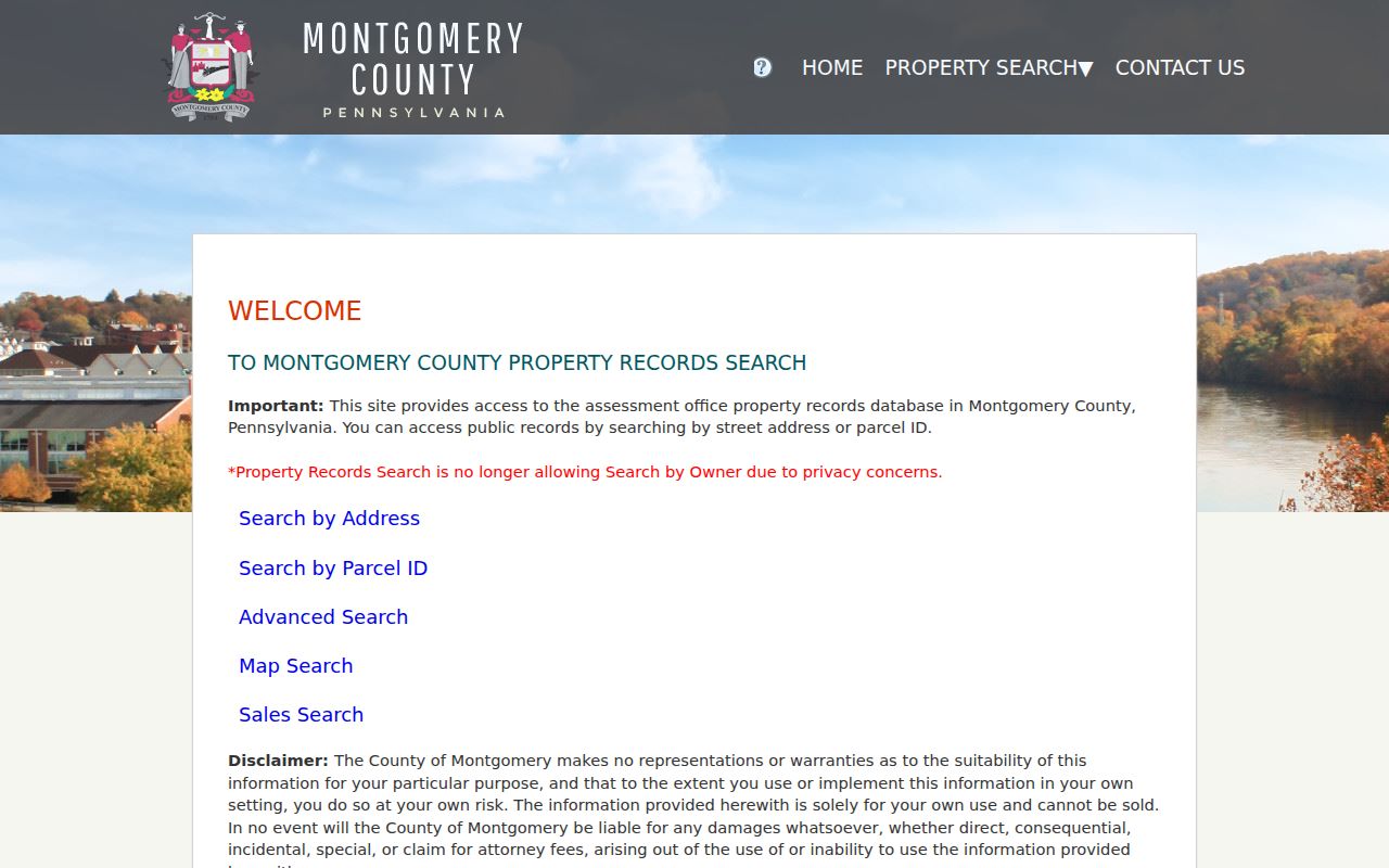
The County landing screen shows the distinct search modes that lead from an address to a selected parcel and then to the bounded map method.
Lower Merion Neighbors and Parcels
A parcel profile can show owner names, a care-of field, a mailing address, property location, assessment fields, sale history, deed book/page, grantor, grantee, and recorded date. That is valuable evidence about land and a correspondence path. It does not prove that the listed owner lives at the property, that everyone there is listed, or that the same people occupy the property after a transaction. Estates, trusts, entities, and different mailing addresses are all reasons to keep the record label intact.
This distinction protects research on Lower Merion neighbors from a common mistake. A map can put properties beside each other. It cannot turn an ownership result into a personal profile. A voter record, a community publication, a court docket, or a historical directory also has its own limit. Use them as separate, dated records and retain the role shown by each source: owner, grantee, grantor, party, or association participant.
- Situs address
- The physical property location shown in an assessment record.
- Mailing address
- The address used for correspondence, which may differ from the situs.
- Parcel
- The county identifier that connects map, assessment, and sale information.
- Buffer
- A selected distance around a parcel used to identify nearby mapped parcels.
Mapping Lower Merion Neighbors
Use the block method as a sequence of record checks. It begins with a known address and ends when the source stops supporting the claim. For an immediate property question, a selected parcel and buffer search are enough to see the nearby land pattern. For a historic question, follow the property’s sale fields to the relevant recorded document and compare a dated atlas plate. For broader street work, use the named-street process rather than widening a small buffer indefinitely.
- Locate the exact address in Montgomery County Property Records and save the parcel identifier.
- Use the parcel buffer with a stated distance, tax year choice, and the include-selected setting.
- Open nearby parcel profiles and record only the property, owner, mailing, sale, and deed fields displayed for each parcel.
- Use the Recorder’s document index when a book/page or party needs confirmation.
- Compare historic maps or dated local materials when the question concerns an earlier block.
For the full chain along a named road, the Lower Merion by-street directory follows a different, street-scale workflow.
Lower Merion Neighbors in Historic Atlases
The Township’s Historic Property Atlases provide a rare local series for block history: 1871, 1877, 1881, 1886, 1887, 1896, 1900, 1908, 1912, 1913, 1920, 1926, 1937, 1948, and 1961. The Township guide says a researcher can compare plates from later to earlier editions to see lot patterns, roads, building footprints, and some owner labels. A footprint’s first appearance can narrow a construction interval, but it cannot give an exact construction date by itself.
Historic address matching needs extra care in Lower Merion. Streets changed, many plates do not show house numbers, and villages or rail corridors can be the more stable feature. The official house-history brief recommends using a cross street, lot geometry, railroad line, Mill Creek, legal description, and adjacent owner when the number fails. A block should be treated as a dated map pattern, not as the same group of people across every atlas edition.
Use the Township’s Historic Property Atlases for the online plate sequence.
Lower Merion Civic Association Routes
Community material can help name a neighborhood or identify a local institution, but it is not a public household directory. The Township’s residents page links civic associations and the Federation of Lower Merion and Narberth civic associations. Those links are a useful way to find the current association route for a particular area. They do not establish election boundaries, parcel lines, or a roster of every household on a block.
For older local context, Lower Merion Historical Society holds maps, yearbooks, community publications, clipping files, and archival material. Its collections include selected Bala-Cynwyd and Main Line directory-like publications, but the research does not establish that any of them are current or complete neighborhood rolls. Ask for a specific place, date, publication, or organization and preserve the edition or collection reference with each result.
| Lower Merion community route | Best use | Boundary |
|---|---|---|
| Township residents page | Links to civic associations and the Federation | Not a parcel or election map |
| Historical Society research support | Request maps, publications, and local context | Holdings may need staff or in-person review |
| Township library network | Ask for local-history, map, newspaper, or referral holdings | Exact branch holdings need confirmation |
Lower Merion Neighbors and List Limits
Pennsylvania’s public voter-list channels are not an unrestricted block browser. Montgomery County’s public-list request form offers defined public-information and street-list choices, asks for requester identity, a description, and a signed statutory affirmation, and accepts mail, email, fax, or in-person delivery. The state form separately defines a public-information list, street list, walking list, and fuller export. Each form describes terms and limits that govern the request and any resulting data.
Use the Township’s address-based ward and precinct route for current civic geography. Lower Merion redrew ward boundaries for 2025, so historic and current geography should not be mixed. A street-list result, if properly requested, is not proof of a whole household or a basis for contact. It should remain in the official channel and be read only for the permitted purpose stated in the request.
Lower Merion Neighbors and Official Tools
Official records and commercial neighbor tools serve different purposes. An official map, property roll, or recorded document can be traced to a named custodian and a field shown in that custodian’s system. A commercial category may be convenient, but it can combine sources with different dates and omit the role, access rule, or correction path. The better choice depends on whether the question needs a parcel boundary, a recorded deed, a dated historic clue, or only a starting point for verification.
| Source category | Strength | Check before relying on it |
|---|---|---|
| County or Township source | Known custodian, record type, and access route | Read the field label, date, and source disclaimer |
| Local archive or library | Dated community and historical context | Confirm edition, coverage, and identity link |
| Commercial category | May offer a quick lead | Verify against the actual public custodian record |
Lower Merion Block Geography
Lower Merion’s records geography changes across time. The Township was established in 1713, while Montgomery County land records begin in 1784 and earlier land work can cross into Philadelphia deeds, patents, and warrant books. Narberth became a borough in 1895. Postal labels for Bala and Cynwyd also have their own history. An early source can name a place familiar today without referring to the same municipal parcel or civic unit.
For an old block, start with the current parcel and move backward through the deed chain and atlas plates. The 1851 John Levering Map, reproduced with the 1908 A.H. Mueller atlas, is a local bridge before the 1871 atlas run. These details explain why a name-only or ZIP-only search fails. A block is best established through dated parcels, roads, nearby labels, and the municipality in force at the time.
Limits on Lower Merion Neighbor Searches
Research on Lower Merion neighbors should stop at the record boundary. A property owner can be an individual, estate, trust, entity, or correspondence address. A historic atlas can identify a prior lot label but not a current household. A court record can carry a party role and date, not a finding about a person’s present life. A no-result can reflect a known missing book range, an undigitized collection, a protected address, or an index limitation rather than absence from the community.
Pennsylvania’s Address Confidentiality Program permits eligible participants to use a substitute address in government, court, driver, vehicle, voter, school, and marriage records. Keep protected addresses and restricted voter data within the custodian’s rules. When records conflict, retain separate candidates and seek the relevant official source instead of trying to create a complete block profile.