
Lower Merion ZIP Code Coverage
Lower Merion is not served by one ZIP Code. A Township planning survey identifies a nine-code Lower Merion and Narberth study set: 19003, 19004, 19010, 19035, 19041, 19066, 19072, 19085, and 19096. The set is useful for finding the postal label associated with an address, but it is not a fixed Township boundary and never identifies who lives in a delivery area. The table keeps that distinction visible. Individual post-office service assignments should be checked through USPS rather than inferred from a community name.
| ZIP | Areas Covered in Local Research | Post Office | Notes |
|---|---|---|---|
| 19003 | Ardmore postal label | Verify with USPS | Ardmore spans more than one municipal area. |
| 19004 | Bala Cynwyd postal label | Verify with USPS | Bala and Cynwyd share postal-history context; parcel lines are more exact. |
| 19010 | Bryn Mawr postal label | Verify with USPS | Mailing use extends beyond a simple village boundary. |
| 19035 | Gladwyne postal label | Verify with USPS | Confirm coverage street by street. |
| 19041 | Haverford postal label | Verify with USPS | Also connected to adjacent county and township context. |
| 19066 | Merion Station postal label | Verify with USPS | Postal label differs from the Township name. |
| 19072 | Narberth postal label | Verify with USPS | Narberth is an independent borough, not Lower Merion Township. |
| 19085 | Villanova postal label | Verify with USPS | Community references can cross familiar municipal lines. |
| 19096 | Wynnewood postal label | Verify with USPS | Postal or local name is not a parcel-jurisdiction finding. |
The Township’s planning material also describes Lower Merion as a collection of smaller neighborhoods and identifies 16 planning or village areas. Those local names are valuable search clues, especially in historic material. They still need a present street address, parcel, or municipal field before they are treated as a Lower Merion Township record connection.
Verify a Lower Merion ZIP
Use the USPS ZIP Code Lookup to confirm the current delivery ZIP for a standardized street address. It is the authoritative check for today’s mail routing. USPS does not establish Township jurisdiction, prove a parcel boundary, resolve an old street number, or identify people at an address. A valid postal response is therefore the first step, not the final answer for a Lower Merion ZIP code directory search.
The USPS lookup screen is the appropriate source for current delivery validation.
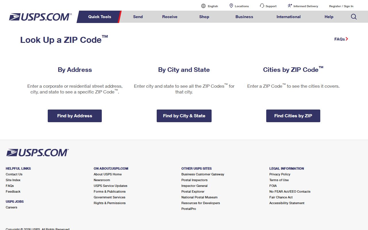
Record the address exactly as validated, including the ZIP Code. Next, use the county parcel profile to check the municipality and parcel identity. If the question involves current local civic geography, check the Township ward and precinct result as well. For a historic address, preserve the postal result as a current label while the older research follows maps, parcel references, street variants, and legal descriptions.
- Enter the complete current street address in USPS and retain the delivery ZIP Code returned for that address.
- Open the county property record by address, parcel, or map to verify the property location and municipal field.
- Use the Township ward and precinct lookup when current Lower Merion civic geography matters, and note the access date.
- For a historic or ambiguous address, compare the parcel and street context with the historical atlas instead of forcing an old address into a current postal result.
Lower Merion Parcel ZIP Checks
The Montgomery County Property Records system is the needed companion to a ZIP Code result. It offers address, parcel, advanced, map, sales, and buffer modes. Its owner-name search accepts an asterisk wildcard, and the map and parcel modes help when an address has changed or is unclear. The portal does not expose ZIP as a confirmed public people-search filter in the research capture. Use it to establish parcel geography, not to assemble a ZIP-wide resident list.
The county property-search page shows the separate parcel and map routes.
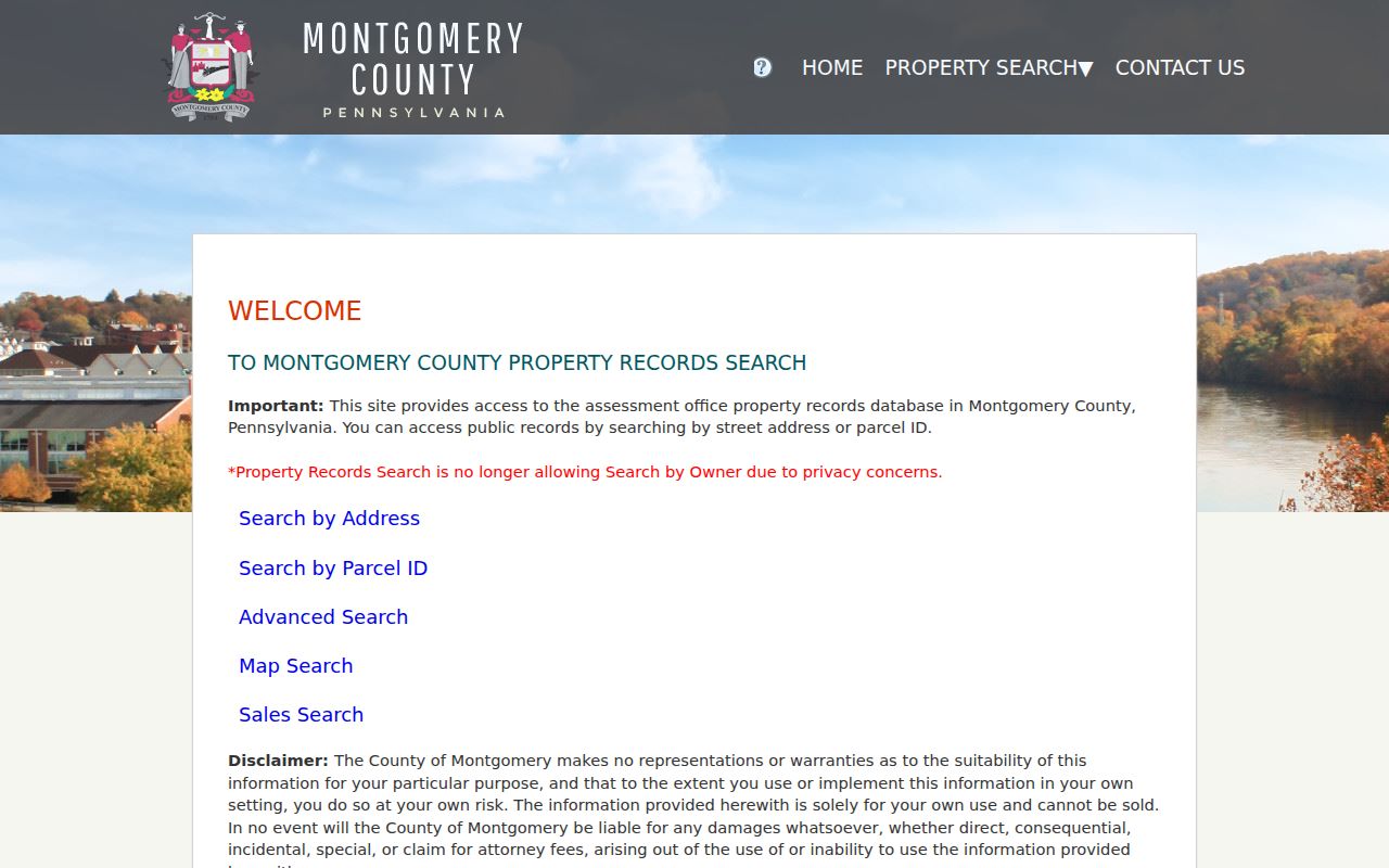
A parcel profile can show the property location, PARID, TaxMapID, municipality, school district, land-use details, owner and mailing fields, sale history, deed book/page, grantor, grantee, and recorded date. The owner mailing field may differ from the property location, so it cannot confirm an occupant or the delivery ZIP. County materials say property records update weekly, maps daily, and photos quarterly, and they also say the map data is not a legal description.
| Parcel-profile field | Useful ZIP-directory role |
|---|---|
| Property location and municipality | Tests whether the address is in the Township or another municipal area. |
| PARID and TaxMapID | Provide stable parcel references when a street label or number is uncertain. |
| Map, lot and sale information | Connect current address work to nearby parcels and an anchored transaction. |
| Deed book/page and parties | Provide a bridge to the Recorder’s indexed land-document trail. |
Lower Merion ZIP Code Search
No official Lower Merion public portal documented in the research supports a standalone ZIP-wide people search. The UJS advanced interface visibly includes a ZIP field within parcel-address criteria, but it is a court-record filter, not a resident directory. Likewise, the property portal supports address and parcel research without a confirmed ZIP filter. This is an important limit: ZIP Code coverage narrows an address question, but it does not create a person boundary or an official household list.
For a permitted voter-record question, the state self-status route is for an individual’s own status. Montgomery County’s public-information and street-list form is a separate written-request path with requester identity, a description of the requested records, and a signed statutory affirmation. It accepts mail, email, fax, and in-person delivery, and the form says to allow ten calendar days. Its statutory terms and protected-address rules continue to control the result.
Once a verified address is narrowed to a particular street, use the Lower Merion Township by-street directory for the property, map, deed, and historic-address workflow. That method stays address-specific instead of treating every address sharing a ZIP Code as the same local record area.
Lower Merion ZIP Boundaries
Postal, village, and municipal boundaries do not line up neatly in Lower Merion. Ardmore, Bala Cynwyd, Bryn Mawr, Gladwyne, Haverford, Merion, Narberth, Penn Valley, Penn Wynne, Rosemont, Villanova, and Wynnewood can be mailing or local names. Narberth deserves special care because it is a separate borough even though it appears in the broader local postal landscape. A Lower Merion ZIP code directory should name the postal label, then let the parcel municipality and Township address tools determine jurisdiction.
- ZIP and ZIP+4
- A ZIP Code directs mail to a delivery area. ZIP+4 adds a more specific delivery segment within that area.
- PO-box ZIP
- A ZIP used for post-office-box delivery. The research does not identify any code in this local set as box-only.
- Unique ZIP
- A ZIP assigned to a single organization or large recipient. The research does not identify one for this study set.
- Carrier route
- A Postal Service delivery grouping. It is a mail-routing term, not a municipal or household boundary.
Note: A postal label can be current even when an older property record uses a different village, street, or municipal description.
Lower Merion Postal Name Clues
Bala and Cynwyd have a shared post-office history, while the Township’s local history describes many residents as identifying with village names rather than a single town label. Those names help locate an atlas plate, a newspaper reference, or a community collection. They do not settle the municipal question. The same caution applies to Haverford, whose name can point toward an adjacent county or township setting, and to Ardmore, whose postal label spans more than one municipal area.
This is a useful myth check: a familiar place name in an address is not the same evidence as a county parcel municipality. Keep both forms of the place name in notes, but attach a deed, PARID, TaxMapID, or map result before transferring a record to Lower Merion Township.
Lower Merion Ward Address Checks
The Township’s ward and precinct lookup is another current-address test. It returns the ward, precinct, and Board of Commissioner for an entered address. Township boundaries were redrawn for 2025, so a result should be recorded with its date. A current civic-geography result supports an address’s Township connection, but it does not establish a postal ZIP, parcel ownership, or any person’s registration status.
Use this tool after USPS and parcel confirmation when the record question depends on present local geography. For earlier years, do not project today’s ward result backward. Historic community names, street changes, and boundary history may require an atlas and a deed or parcel bridge instead.
Lower Merion Historic Address Clues
Current ZIP Code data cannot solve an older address by itself. The Township’s historic property atlases cover 1871 through 1961 and can be compared from the latest relevant plate backward. They show changing footprints, lot patterns, owner labels, streets, railroads, and other physical clues. The Township guide warns that street names changed and that many plates lack house numbers.
When a number does not carry back cleanly, compare the footprint, cross street, rail line, Mill Creek, lot geometry, legal description, and adjacent owner labels. The 1851 John Levering Map, reproduced with the 1908 A.H. Mueller atlas, provides a pre-1871 owner-name bridge. This local method is stronger than assuming a present postal assignment existed in the same form during an earlier period.
Lower Merion ZIP Request Limits
Official information remains limited by the record type. Voter-list request forms impose use restrictions, and the Address Confidentiality Program can substitute or withhold an eligible participant’s address in several government records. County property information is for the user’s own use and cannot be sold. A ZIP Code, parcel, map point, or mailing label must not be republished as a claim about a person’s current location.
Use ZIP results carefully. Confirm a property question with its custodian and respect protected-address and list restrictions. Never use a postal or parcel result to stalk, harass, intimidate, or expose someone.
For a suspected parcel-field error, contact the Board of Assessment Appeals with the parcel ID and correction evidence. For a protected-address or voter-list concern, use the appropriate county, state, or ACP channel. A portal result is not a substitute for the custodian’s correction or verification process.