
Search Lower Merion Streets by Address
For a named Lower Merion street, begin with one exact address rather than a surname. The county parcel profile supplies the situs address, parcel identifier, tax-map information, owner mailing field, sale history, grantor, grantee, recorded date, and deed book and page. Those facts create a trackable address record. The owner or mailing field is not evidence that a person lives at the property, so keep ownership and household questions separate from the first search.
- Find the address in the Montgomery County property system and save the parcel ID, municipality, tax map, sale reference, and deed book/page.
- Open the Recorder of Deeds index with the parcel, address, party name, document reference, or recorded date from that profile.
- Read the instrument or obtain a copy, then use its prior-reference recital to locate the earlier deed instead of assuming a name match.
- Use a dated local directory or community publication only as a time-specific clue. Check the edition, printed spelling, and address against parcel and deed evidence.
- For an official street list, use the Montgomery County request form and follow its certification and use terms. The self-status voter tool is not a street browser.
That order gives a Lower Merion street directory a defensible trail: address to parcel, parcel to recorded document, and only then to a dated source that may identify an address association. It also leaves an honest gap when no source supports a match.
Lower Merion Street Records by Source
Several offices keep address-keyed information for Lower Merion, but each answers a narrower question. County parcel data is the practical starting point. The Recorder supplies recorded land documents. Township records can hold a particular permit, plan, or historic file when the record is public. Historic atlases connect an address to an older lot pattern. None of these sources is a universal directory of current people on a street.
| Street-keyed source | Custodian and route | What it establishes | Careful limit |
|---|---|---|---|
| Parcel and assessment profile | Montgomery County property portal | Situs, parcel, owner mailing field, sale and deed reference | It does not prove a household at the address. |
| Parcel map and buffer | County property map and Data & Mapping tools | Lot relationship, selected parcel, nearby parcel context | Map data is not a legal description. |
| Recorded deeds, plans, and mortgages | Montgomery County Recorder index, counter, or mail route | Recorded parties, document date, book/page, legal-title trail | Remote images require an account and subscription. |
| Permit or historic-property file | Lower Merion Building and Planning or a specific RTKL request | Address-linked work, plans, zoning, or historic documentation | An application is not the same as an approval. |
| Dated atlas or community publication | Township atlas collection, LMHS, library, or named archive | Earlier lot, footprint, owner-label, or printed address clue | Coverage varies by edition and source. |
When the county property screen supplies a parcel number but a historic source has only a street or lot reference, use the legal description and mapped features as the bridge. Do not fill the gap by assuming the same street name always had the same numbering.
Note: A parcel owner can be an estate, trust, entity, or correspondence address, so ownership is not a substitute for a household roster.
Use Lower Merion Property Search Fields
The Montgomery County Property Records portal provides the strongest current address starting point for the Lower Merion street directory. Its distinct modes include address, parcel, advanced, map, sales, and buffer search. Owner-name searching accepts a wildcard, while the buffer route starts from a selected parcel and asks for a distance in feet. The property profile also provides the sale and deed clues that let an address search become a recorded-document search.
| Portal field or mode | Input type | How it helps a street search |
|---|---|---|
| Search by Address | Dedicated mode | Locates a property profile by a present address. |
| Search by Parcel | Dedicated mode | Preserves a stable county identifier when an address changed. |
| Map Search | Dedicated mode | Helps compare a street, lot shape, and surrounding parcels. |
| Sales Search | Dedicated mode | Leads to sale history and a deed reference. |
| Owner search | Text, wildcard accepted | Smith, Smith J, Smith John, and *Jane follow the county's published examples. |
| Buffer Search Distance | Required numeric feet value | Frames nearby parcels after a parcel is selected. |
| Tax Year | Optional selector | The inspected interface showed Any and 2025. |
The property portal states that property records update weekly, maps daily, and photos quarterly. Treat the screen as a current county reference, not a permanent historical snapshot. Its own terms say the data is for the user's own use, cannot be sold, carries no warranty, and is not a legal description.
The county property-search screen is shown in the official portal capture below.
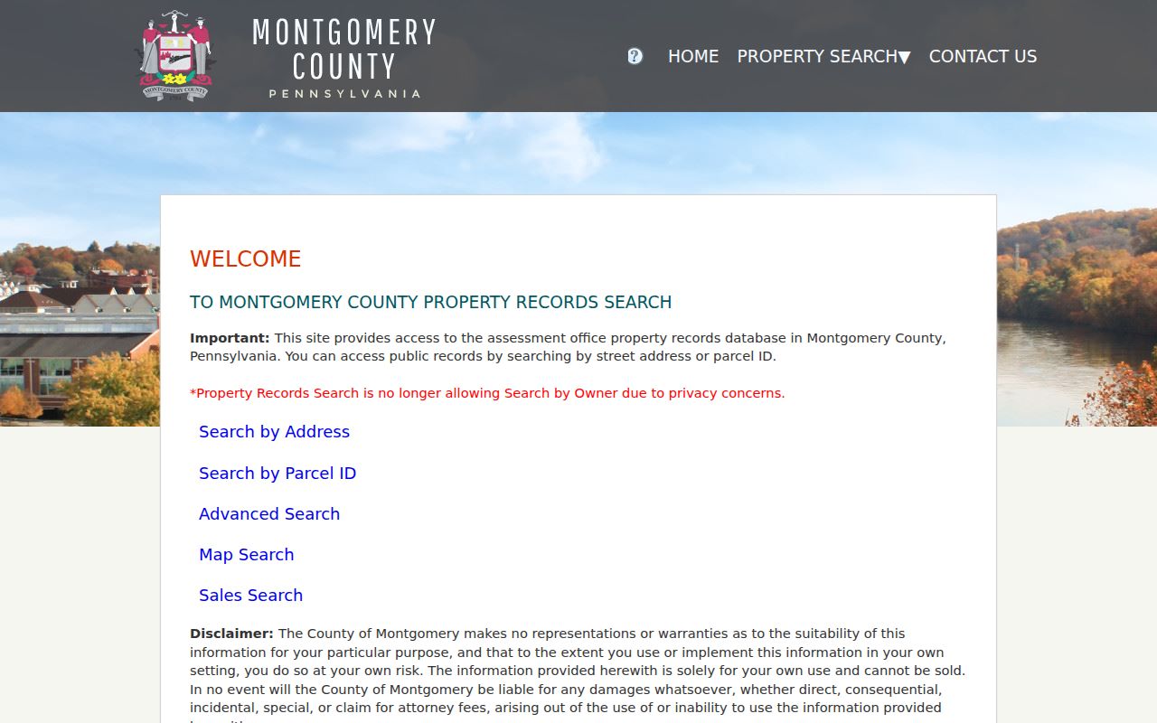
The separate address, parcel, map, sale, and buffer routes make the portal useful for narrowing one Lower Merion street without claiming that it lists every person there.
Lower Merion Street Directory Terms
Address research becomes much clearer when the record terms are kept straight. County labels can point to the same property from different angles. A street directory result is stronger when the parcel and legal description agree, even if an older map has a different house number or a shortened community name.
- Parcel
- A county-defined property unit identified in the assessment system. It links the present property profile to maps, taxes, and sale records.
- Situs address
- The physical location shown for the property. It can differ from the owner's mailing address.
- Plat or plan
- A recorded map that can show subdivision, lot, or right-of-way information. Recorder plan books use their own book and page conventions.
- Legal description
- The land description carried in a deed or related record. It is often more durable than a street number when tracing older evidence.
- Criss-cross directory
- An address-arranged directory format. No fully inspected Lower Merion criss-cross edition was found in the research, so confirm a specific title and fields before relying on one.
Note: Record the exact spelling shown in each source, including a village label, because postal communities and municipal boundaries do not always align.
Follow Lower Merion Street Deed References
A deed trail begins with the current parcel profile, not a guessed sequence of surnames. The property record can display a sale date, sale price, tax stamps, deed book/page, grantor, grantee, and recorded date. Entering one of those references in the Recorder's Official Record Search anchors the next step to a recorded instrument. The public Quick Search displays Real Property, a Search Term for party, subdivision, document type, or document number, and an optional Recorded Date range.
Montgomery County says its records date to September 10, 1784. The official Lower Merion historic-property method directs researchers to read the deed's recitation of ownership, use the earlier book/page named there, and continue title by title. Before the county's 1784 start, that method shifts to Philadelphia County deeds, patents, and warrant books. A chain of title is a document sequence, not a conclusion drawn from the same last name.
The county Recorder's public-access information explains why a fallback matters. Account creation precedes the search route, remote images are subscription-gated, and documents can also be viewed on public computers at the county office. Plain or certified copies have counter and mail routes. A mail request can include the owner, full address and municipality, parcel ID, book/page, requester contact details, and a return envelope.
The Recorder's access page is represented in this county source capture.
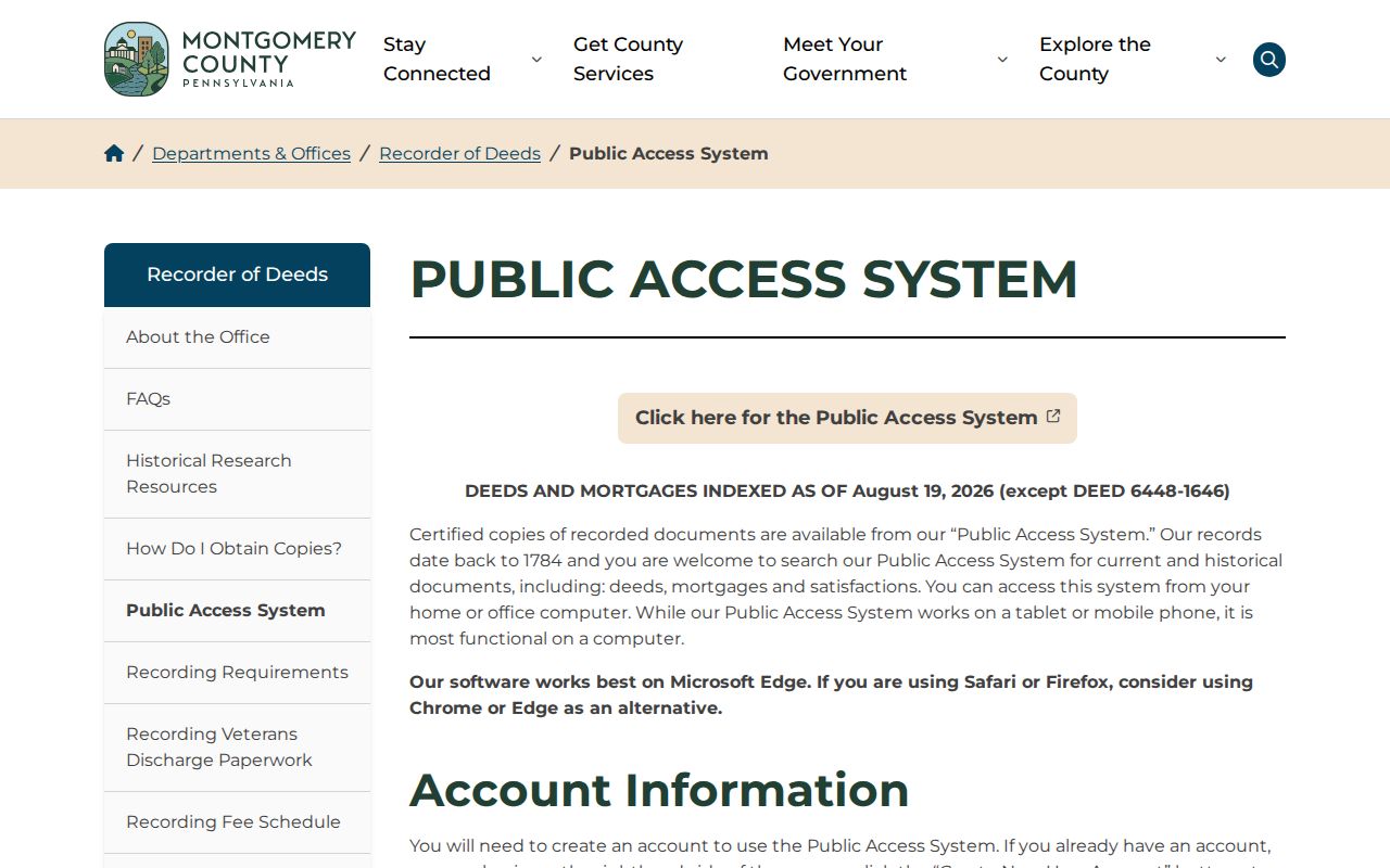
Use the live fee and access pages before ordering a copy. The Recorder lists known deed, mortgage, and plan-book gaps, so a missing image can be a documented gap rather than proof that no transaction occurred.
Map a Lower Merion Street First
For Lower Merion streets with an uncertain old number, a map-first approach is more reliable than a number-only search. Compare the present parcel to its cross streets, lot shape, adjacent parcels, rail corridor, creek, or other durable features. The county property portal's buffer tool starts with a selected parcel, a distance in feet, an optional tax year, and a choice to include the selected record. It frames nearby parcels but does not create a list of neighbors or residents.
The county's GIS Data resources provide current map context, with the county's warning that map data is not a legal description. Pair the map with the assessment profile and deed description. For a changed road alignment or older lot, retain the features that persist across records rather than forcing a modern line onto an old plate.
Note: A street name alone is not enough to connect two historical records when house numbers, municipal labels, or lot boundaries differ.
Lower Merion Streets in Historic Atlases
Lower Merion has a strong local map sequence for address history. The Township's Historic Property Atlases cover 1871, 1877, 1881, 1886, 1887, 1896, 1900, 1908, 1912, 1913, 1920, 1926, 1937, 1948, and 1961. The HARB method says to start with the latest relevant plate and compare backward. A footprint that appears in one edition but not the preceding edition can narrow a construction interval, not establish an exact construction date.
Many plates do not show house numbers, and street names can change. The HARB guide identifies lot geometry, roads, railroads, Mill Creek, adjacent owners, and legal descriptions as useful bridges. The 1851 John Levering Map reproduced with the 1908 A.H. Mueller atlas is an owner-name bridge before the township's railroad-atlas run. This makes historic Lower Merion street research a parcel-and-map exercise before it becomes a name exercise.
Match Lower Merion Street and Postal Labels
Lower Merion is the municipality, while community names can appear differently in mailing and historical sources. Ardmore, Bala Cynwyd, Bryn Mawr, Gladwyne, Haverford, Merion Station, Narberth, Penn Valley, Penn Wynne, Rosemont, Villanova, and Wynnewood may appear as local labels. Narberth is a separate borough. A familiar postal name therefore does not establish that a street address is in Lower Merion Township.
Use the USPS ZIP Code Lookup for a current delivery label, then confirm the municipality in the county parcel profile. The Township's planning research lists nine ZIP codes in the Lower Merion/Narberth study area, but that is not a parcel-level jurisdiction test. A current ward or precinct lookup can add local civic geography after the Township's 2025 boundary redraw, yet it is not proof of a resident's identity or address history.
Request Lower Merion Address Files
Township Building and Planning records can add a property-history layer when a researcher asks for a particular existing file. The Online Permitting Portal is an application route for building, demolition, additions, repairs, roofing, solar, plumbing, electric, HVAC, and zoning work. A submitted application is not an approval, and the research did not identify it as an open historical permit search.
For older material, state the street address, parcel or tax-map ID, approximate dates, and a narrow record class such as a permit ledger, plan index, inspection record, zoning decision, HARB submission, historic survey, or drawing. Lower Merion accepts written RTKL requests in person, by mail, email, or fax. Its policy calls for a response within five business days, while a specific request does not require the Township to create a new compilation. The HARB guide says drawings for many buildings built or altered after 1926 may be viewed through Building and Planning and that historic-district documentation may be available through that department.
Lower Merion Street Lists Use Official Channels
Pennsylvania's voter-registration status tool is intended for a voter to check that voter's own status, not for browsing a Lower Merion street. The documented public route is the Montgomery County Request for Public Lists form. It offers public-information and street-list choices, asks for requester identity, contact information, a description of the request, and a signed statutory affirmation, and permits mail, email, fax, or in-person delivery. The county form says to allow ten calendar days.
Its stated street-list fields are name and address. That narrow description matters: do not join a voter-list result to a parcel record and announce a household. Pennsylvania's Address Confidentiality Program can allow a substitute address in voter and other government records, so an absent or altered address does not show that a person is unregistered or does not live in an area.
Note: Keep voter records within the request form's terms and use a dated county response rather than copying personal data into a new street list.
Limits of a Lower Merion Street Directory
A Lower Merion street directory can show a sequence of public address records, not a guaranteed list of everyone on a street. Parcel records identify property and an owner mailing field. Recorded deeds identify parties to a transaction. Historic atlases label lots or owners in selected years. Community directories and club publications are partial, dated sources. The evidence must be described at that level, especially when a name, postal label, or old number differs between sources.
Personal, lawful research only. Use Lower Merion address records for family history, property history, civic curiosity, or a specific public-record question. Do not use a record trail to track, harass, or harm a living person.
For a past address trail rather than a present street question, the Lower Merion past residents page follows one parcel through deeds, atlases, and dated local sources. It keeps the focus on document-supported history rather than assumed occupancy.